Hurricane Irma Advisory Number 22 NWS National Hurricane Center Miami FL AL112017 500 PM AST Mon Sep 04 2017
...IRMA STRENGTHENS AS IT HEADS TOWARD THE LEEWARD ISLANDS... ...PREPARATIONS WITHIN THE WARNING AREA SHOULD BE RUSHED TO COMPLETION...
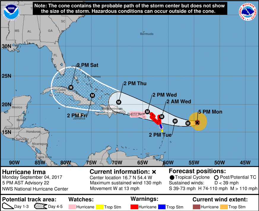
LOCATION...16.7N 54.4W ABOUT 490 MI...790 KM E OF THE LEEWARD ISLANDS MAXIMUM SUSTAINED WINDS...130 MPH...215 KM/H PRESENT MOVEMENT...W OR 265 DEGREES AT 13 MPH...20 KM/H MINIMUM CENTRAL PRESSURE...944 MB...27.88 INCHES
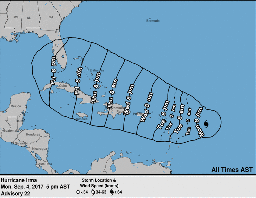
At 500 PM AST (2100 UTC), the center of Hurricane Irma was located near latitude 16.7 North, longitude 54.4 West. Irma is moving toward the west near 13 mph (20 km/h) and this general motion is expected to continue into Tuesday, followed by a turn toward the west-northwestward late Tuesday. On the forecast track, the center of Irma will move near or over portions of the northern Leeward Islands Tuesday night and early Wednesday.
Data from an Air Force Reserve Hurricane Hunter aircraft indicate that the maximum sustained winds have increased to near 130 mph (215 km/h) with higher gusts. Irma is a category 4 hurricane on the Saffir-Simpson Hurricane Wind Scale. Additional strengthening is forecast during the next 48 hours.
Hurricane-force winds extend outward up to 40 miles (65 km) from the center and tropical-storm-force winds extend outward up to 140 miles (220 km).
The latest minimum central pressure reported by reconnaissance aircraft is 944 mb (27.88 inches).
Next intermediate advisory at 800 PM AST.
Next complete advisory at 1100 PM AST.